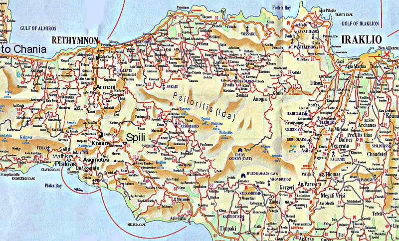
The distance to Plakias from Heraklion is 120km, all crossings have signs.
The "New Road" (Crete's only highway) leads past the airport, enter it in the direction to Chania / Rethymnon. 80km later the city of Rethymnon can be seen to the right, after passing a bridge take the next exit to Spili. After 20km turn right for the last 15km along the winding road to Plakias.
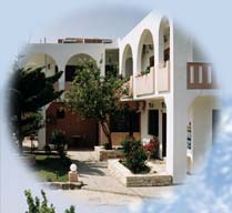
The
local map of Plakias shows further details.
hint: please watch the driving mirror before stopping spontaneously, choose an open area and use the car's winker to avoid misunderstandings.